Annapurna
Annapurna Base Camp Trek Difficulty: How Hard Is It?
When trekkers ask me about the Annapurna Base Camp trek difficulty, I usually tell them not to worry too much about the…
S
Saligram
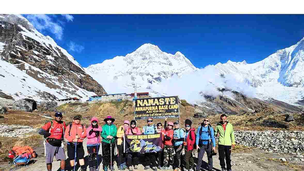
This Annapurna Base Camp Trek Itinerary covers 10 days from Kathmandu, including six days of trekking and five nights on the trail. The route reaches 4,130 metres at Annapurna Base Camp and does not include Poon Hill.
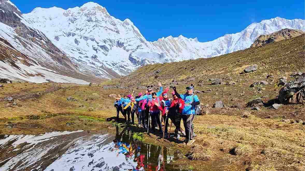
This Annapurna Base Camp Trek itinerary covers 10 days from Kathmandu, including six days of trekking and five nights on the trail. The route reaches 4,130 metres at Annapurna Base Camp and does not include Poon Hill.
I first trekked to Annapurna Base Camp in 1996 as a porter, when the route was still mainly a camping trek. Today, the same route is a teahouse trek, with accommodation and meals available along the trail.
This Annapurna Base Camp Trek follows the direct route through Chhomrong, Bamboo, Deurali and Machhapuchhre Base Camp before returning along the same trail. The itinerary below gives you the walking distance, time, altitude, overnight stop and what to expect each day before returning to Pokhara and Kathmandu.
Kathmandu, then Pokhara, then a drive to the trailhead. From there, the route climbs through Chhomrong, Bamboo, Dovan, Himalaya and Deurali before reaching Machhapuchhre Base Camp and Annapurna Base Camp on Day 6.
From Base Camp, it’s a hard two-day descent back to the road, followed by the drive to Pokhara and the return to Kathmandu. Day 10 is your departure day, unless you decide to extend your time in Nepal.
The highest point is 4,130 metres at Annapurna Base Camp. The number itself does not tell you how demanding the trek feels. The trail has plenty of stone steps, steep descents and climbs that give back some of the elevation you have already gained.
Altitude: 1,350 m | Walking: No trekking | Accommodation: Kathmandu | Meals: No meals
Nothing physically demanding today. You land, settle in, and meet whoever’s guiding you before the trek starts properly two days from now.
Most flights into Kathmandu land around midday or in the afternoon. By the time you clear immigration, collect your bags and get through the airport traffic, you’re usually looking at hotel check-in by early evening.
It’s important for first-timers not to plan anything ambitious for this day. Jet lag hits differently depending on where you’ve flown from, and Kathmandu itself takes some adjusting to even without a long flight behind you. The noise, traffic and density of Thamel can be a lot after a long journey.
This is also when your gear gets checked. Usually, your guide will go through what you’re carrying, answer whatever is still bothering you about the trek and point out anything missing from your kit that you should sort out before Day 3.
If you’ve been putting off buying or renting something, Kathmandu is where you fix it, specifically around Thamel. Don’t wait until Pokhara. The selection there is thinner.
For permits, your guide or trekking agency should confirm the current requirements for your exact route before departure. The Annapurna Conservation Area entry permit is required for the trek, and your trekking agency can arrange the required permits and TIMS before you start. This is covered in our Annapurna Permits Guide.
Altitude: 850 m | Driving: About 6–8 hours by road | Distance: About 200 km by road | Accommodation: Pokhara | Meals: Breakfast
A travel day, either by flight or road, that drops you into Pokhara with your first proper look at the Annapurna range.
I’ve done this leg by both plane and road more times than I’d like to count. My honest advice is this: fly if your schedule and budget allow it.
The drive is scenic in places, but it is also long and can be rough. The Trishuli Valley, terraced hillsides and the road following the river for long stretches are all worth seeing, but the journey takes up a large part of the day.
Pokhara sits lower than Kathmandu, and you feel the difference when you arrive. Softer air, a lake instead of a traffic jam, and on a clear evening, your first proper view of Machhapuchhre and the Annapurna range from around Lakeside.
I always tell people to actually look up that evening rather than heading straight for dinner. It is a good first look at the mountains before you start walking toward them.
Altitude: 2,170 m | Driving: About 2–3 hours | Walking: About 3–4 hours | Distance: Approximately 5–7 km | Accommodation: Chhomrong | Meals: Breakfast, lunch and dinner
A morning drive to the trailhead followed by your first real trekking day, ending at Chhomrong, the last major village before the trail narrows into the gorge.
This day has two distinct halves, and I think a lot of trekkers underestimate the first one. The drive out of Pokhara toward the trailhead can take a couple of hours, depending on the current road conditions and where the vehicle can reach.
It’s not always a comfortable ride. Bring something to brace against and don’t expect to sleep through the rougher sections.
Once you’re walking, the terrain becomes what many people picture when they imagine trekking in Nepal: stone steps through terraced farmland, small settlements and mountain paths shared with local people and mule trains carrying supplies.
Chhomrong itself sits dramatically on a ridge, with a steep section of steps running through the village. It is one of the last places on this route with a wider choice of teahouses and food before the trail becomes more remote.
It’s always nice to see trekkers enjoy Chhomrong a little because things become simpler after this point. After dinner, your guide will go through tomorrow’s walk to Bamboo, including the steep descent from Chhomrong, the climb back toward Sinuwa, the forest section and the expected walking time. You’ll also be told what to keep in your daypack and what can stay with the porter.
Altitude: 2,310 m | Walking: About 5–6 hours | Distance: Approximately 7–8 km | Accommodation: Bamboo | Meals: Breakfast, lunch and dinner
A day that looks easy on paper, with only a small net elevation gain, but hides a long drop and climb through the Chhomrong gorge before the trail settles into forest.
This is the day that catches people off guard. The elevation difference between Chhomrong and Bamboo is small, but the actual terrain between the two villages is anything but flat.
You drop steeply out of Chhomrong on stone steps, cross the Chhomrong Khola at the bottom, and then climb back up the other side toward Sinuwa. It is a real push and usually the first day when people understand that the elevation numbers do not tell the whole story.
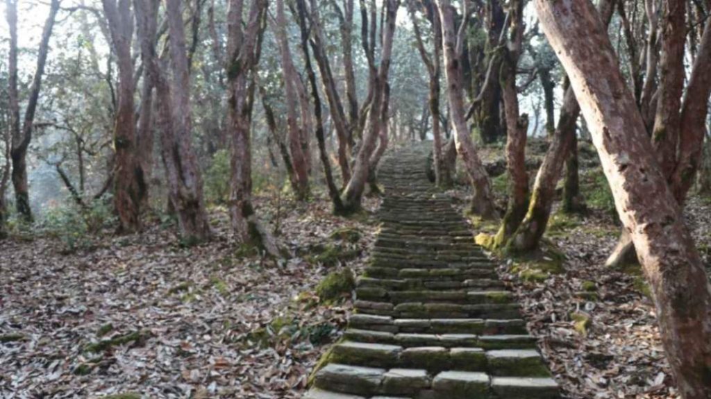
Past Sinuwa, the trail changes character. You move into dense forest with bamboo, rhododendron and moss-covered rock. The temperature and light change with it, and the forest is cooler and darker even in the middle of the day.
This stretch is where I often see people’s mood lift. After the more open walking around the villages, being inside the forest gives the group a different feeling.
Bamboo itself is a small cluster of teahouses named, unsurprisingly, for what surrounds it. It is a practical overnight stop rather than a destination in its own right. After dinner, your guide will brief you about the next day’s climb to Deurali. The route passes through Dovan and Himalaya before the forest begins to thin, and the altitude increases considerably. This is also the point where we start paying closer attention to how everyone is feeling, so mention any headache, unusual tiredness or loss of appetite before you go to bed.
Altitude: 3,230 m | Walking: About 5–6 hours | Distance: Approximately 8–10 km | Accommodation: Deurali | Meals: Breakfast, lunch and dinner
This is the day when altitude starts to matter. You gain nearly 900 metres through narrowing forest and pass through Dovan and Himalaya before reaching Deurali.
Between Bamboo and Deurali, the trail passes through Dovan and Himalaya, each one smaller and more basic than the last. The forest gradually thins as you climb. Somewhere beyond Himalaya, the trail passes beneath the Hinku Cave overhang.
It’s a stretch every guide I know walks through with a little more attention than the surrounding trail. The area has a history of avalanche activity in the wrong conditions, so your guide will check conditions and tell you where to walk.
By the time the trees give way and you’re walking through more open, rockier terrain toward Deurali, most people notice their breathing differently for the first time on this trek. Nothing alarming by itself, but the air is thinner than it was two days earlier.
This is also where I start watching my groups more closely. Deurali is high enough that altitude symptoms can begin to show. If someone develops a headache, loses their appetite or feels unusually tired, I want to know about it before we climb higher. After dinner, the guide will explain the following day’s walk, which is the main day of the trek. You’ll leave Deurali for Machhapuchhre Base Camp and then continue into the Annapurna Sanctuary to Annapurna Base Camp at 4,130 metres. We go over the early start, expected walking time, weather conditions and the importance of staying together and reporting any altitude symptoms early.
Altitude: 4,130 m | Walking: About 5–6 hours | Distance: Approximately 8–9 km | Accommodation: Annapurna Base Camp | Meals: Breakfast, lunch and dinner
The big day. You climb from Deurali through Machhapuchhre Base Camp before continuing into the Annapurna Sanctuary and reaching Annapurna Base Camp.
You’re gaining serious altitude after only a short time above 3,000 metres, so it is worth being honest about the effort before you start.
The walk to Machhapuchhre Base Camp covers open and increasingly dramatic terrain, with Machhapuchhre’s fishtail summit above you. Most groups pause here, not only for the views but also to check how everyone is feeling before the final section.
From MBC to Annapurna Base Camp itself is shorter, but this is where the character of the trek changes completely. The valley opens into the Annapurna Sanctuary, with Annapurna I, Annapurna South, Hiunchuli and Machhapuchhre surrounding you.
I’ve walked into that clearing more times than I can count and it still stops me for a second every time.
This is also the highest point of the trek, so altitude symptoms need to be taken seriously. A headache, nausea, unusual weakness or other symptoms should be reported to your guide rather than ignored because you have almost reached Base Camp. After dinner, your guide will explain tomorrow’s descent to Bamboo. You will retrace the route through Machhapuchhre Base Camp, Deurali, Himalaya and Dovan before reaching Bamboo. It is a long downhill day, so we talk about protecting your knees, using trekking poles if you have them and keeping enough water and snacks with you.
Altitude: 2,310 m | Walking: About 6–7 hours | Distance: Approximately 12–15 km | Accommodation: Bamboo | Meals: Breakfast, lunch and dinner
A long, hard descent day, with nearly 1,800 metres of elevation loss, that tests your knees much more than it tests your lungs.
This is, in my experience, the day people underestimate most. Everyone prepares for the climb to Base Camp. Almost nobody prepares properly for the descent that follows it.
You retrace the route through MBC, Deurali and the forest past Himalaya and Dovan before reaching Bamboo. By the afternoon, your knees and thighs are doing most of the complaining rather than your lungs.
If you’ve trained specifically for downhill walking, this is the day that preparation pays off. Trekking poles can also make a noticeable difference on the longer descents.
There is a real relief that comes with the thicker air on the way down. Appetite often returns, sleep can become easier and the forest that felt harder while climbing can feel completely different when you’re descending through it. After dinner, your guide will go through the final trekking day. Tomorrow you retrace the trail toward Sinuwa and Chhomrong before continuing down to the road and driving back to Pokhara. The guide will confirm the morning start, vehicle arrangements and expected arrival time, so you know what to expect before leaving the mountains.
Altitude: 850 m | Walking: About 4–6 hours | Distance: Approximately 9–12 km | Driving: About 2–3 hours | Accommodation: Pokhara | Meals: Breakfast and lunch
The last trekking stretch back toward the road, followed by the drive to Pokhara and, for most people, the first proper shower after several days in the mountains.
You retrace the trail from Bamboo toward Sinuwa and Chhomrong before continuing down to the road. It is a full day, but a different kind of full from Day 7. You already know the terrain, and most groups move more efficiently on ground they’ve crossed once before.
Chhomrong on the way back tends to get a slightly longer pause than it did on the way up. People often stop for food or one last look around before leaving the mountain section.
The drive back into Pokhara closes out the trekking part of the trip. After several days of teahouses and mountain bathrooms, the first hotel shower back in Pokhara is something most trekkers appreciate immediately. Before you settle into the evening, your guide will confirm the following day’s travel arrangements back to Kathmandu. If you’re flying, you’ll be told the flight time and airport arrangements. If you’re travelling by road, the guide will confirm the morning departure and expected driving time.
Altitude: 1,350 m | Driving: About 6–8 hours by road | Distance: About 200 km by road | Accommodation: Kathmandu | Meals: Breakfast
Another travel day back to the capital, by flight or road, with the trek itself now behind you and nothing physically demanding left on the schedule.
Most trekkers use this day to properly rest for the first time since arriving in Nepal. Kathmandu can also be useful for picking up souvenirs or gifts now that you are no longer rushing to prepare for the trek.
If you have an evening flight the following day, keep this day simple. After a demanding trek, there is no need to fill every hour. Before going to bed, make sure your passport, flight documents and luggage are ready for the next morning. If you are extending your Nepal trip instead of flying home, this is also the time to confirm the arrangements for your next destination.
Altitude: 1,350 m | Walking: No trekking | Meals: Breakfast
Fly home, or stretch the trip further.
Plenty of trekkers treat this as a straightforward departure day. Others use the extra time for Chitwan, more time in Pokhara or another shorter trek.
If you’re considering an extension, it is worth sorting it out before you arrive in Nepal rather than trying to arrange everything on Day 9 with a fixed international flight already booked.
It does not include a dedicated overnight in Ghandruk or Jhinu Danda, which are included in some other versions of the route. It follows the direct route to Annapurna Base Camp through Chhomrong, Bamboo and Deurali, then returns through the same trail before heading back to Pokhara.
If you prefer to include Ghandruk, Jhinu Danda or Poon Hill, the route and number of days can be changed.
Menus stay reasonably varied through Chhomrong, then become more limited as you climb. By Deurali and Base Camp, you’re eating what the teahouses can bring up, and dal bhat becomes one of the most practical choices.
For the full breakdown of meals and prices, see our Annapurna Base Camp Teahouse Food Guide.
The walking route stays broadly the same, but conditions change with the season. October and November usually bring clearer mountain views and more trekkers. March and April bring spring flowers and rhododendron forests.
Monsoon brings more rain, clouds and wet sections of trail, while winter can bring much colder conditions and snow around the higher parts of the route.
For a month-by-month breakdown, see our Best Time to Trek Annapurna Base Camp Guide.
The cost depends on whether you trek independently or use an operator. Guide and porter arrangements, accommodation, transport and personal spending all affect the final amount.
For the current cost breakdown, see our Annapurna Base Camp Trek Cost Guide.
Talk to your guide honestly every day about how you’re actually feeling, not how you think you’re supposed to be feeling.
On a trek that reaches 4,130 metres, speaking up early matters. If someone develops a headache, nausea, unusual weakness or other altitude symptoms, the guide needs to know before the group continues higher.
Full information about altitude symptoms, acclimatization and what to do if someone becomes unwell is covered in our Altitude Sickness in Nepal Guide. Read it before you go, not after something has already gone wrong.
Ten days is one way to walk the Annapurna Base Camp route, and this itinerary follows the direct route without Poon Hill.
If you want to discuss this itinerary, add Poon Hill or include Ghandruk or Jhinu Danda, get in touch before you book. We can look at the walking days, transport and your available time and plan the route accordingly.
Yes. This is a standard 10-day Annapurna Base Camp itinerary from Kathmandu, including six trekking days and five nights on the trail.
Day 6 to Annapurna Base Camp is the hardest climbing day because of the altitude and elevation gain. Day 7 is the hardest descent because of the long downhill sections and the pressure on your knees.
No technical trekking experience is required, but you need to be comfortable walking for several hours a day and handling repeated climbs and descents.
Yes. The trek reaches 4,130 metres, and the upper section gains elevation relatively quickly. Fitness does not prevent altitude illness, so report symptoms to your guide early.
Both options works. Flying saves several hours, while the road journey gives you more time to see the countryside. Your choice depends on your budget, schedule and current transport conditions.
You can extend the trip to Chitwan, spend more time in Pokhara or add another shorter trek. Plan this before your international flight so you have enough time.
Chhomrong has a wider choice of teahouses and food than the higher sections of the route. After Chhomrong, the trail becomes more remote and the facilities become simpler.
The highest point is 4,130 metres, but the total climbing and descending across the trekking days is much greater because the trail repeatedly rises and falls. The stone steps around Chhomrong are a good example of why the highest altitude alone does not describe the difficulty.
If someone develops altitude symptoms or is not adjusting well, the itinerary can need to change. A good guide should assess the person rather than simply follow the original schedule.
The Annapurna Conservation Area entry permit is required for the route, and current Nepal Tourism Board information also requires TIMS for trekking. Your trekking agency can arrange the required permits and TIMS before you start, but confirm the current requirements for your exact itinerary before departure.
When trekkers ask me about the Annapurna Base Camp trek difficulty, I usually tell them not to worry too much about the…
Saligram
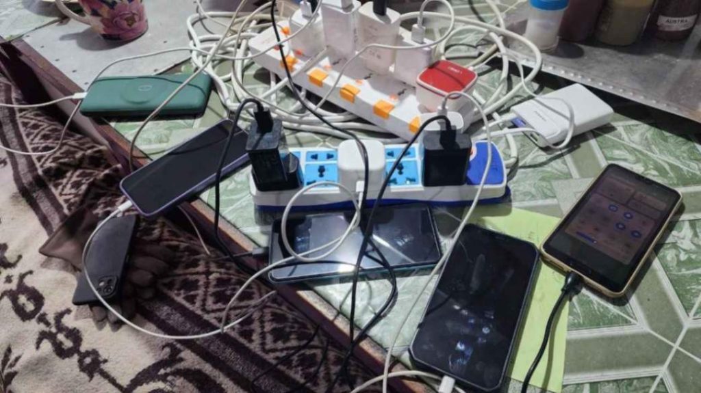
The Annapurna Base Camp Trek has hot showers, electricity, phone charging and Wi-Fi along the route, including at Annapurna Base Camp. Mobile…
Saligram
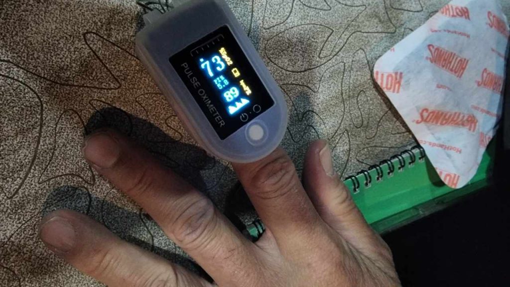
Altitude sickness can affect trekkers on the Annapurna Base Camp trek, especially as the trail climbs toward Machapuchare Base Camp at about…
Saligram


