I first came to the Khumbu in 1997 as a young porter. At that time, I was carrying loads for trekkers and learning the trail step by step. I later worked as a porter-guide, became a licensed guide in 2002, and I have continued walking in the Khumbu ever since. I still guide trekkers here today. If you are planning the Everest Base Camp Trek, it helps to understand the valley before you start because the route is not the same from Lukla to Base Camp.
The walk from Lukla to Everest Base Camp starts with forests, farmland, and river valleys and finishes among rock, moraine, ice and glaciers. If you prefer not to walk back the same route, my Everest Base Camp Trek Helicopter Return is another option, with the trek continuing to the upper Khumbu before flying out after Everest Base Camp and Kala Patthar.
Khumbu Valley at a Glance
| Detail |
Information |
| Region |
Khumbu, Solukhumbu, Nepal |
| Main trekking route |
Lukla to Everest Base Camp |
| Starting point |
Lukla, about 2,860 m |
| Main town |
Namche Bazaar |
| Main acclimatization stops |
Namche and Dingboche |
| Highest overnight settlement |
Gorak Shep, about 5,164 m |
| Everest Base Camp |
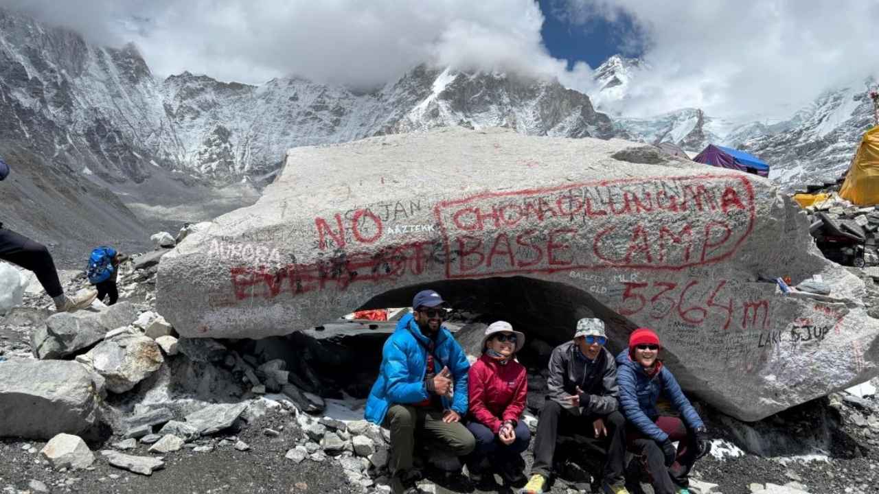
5,364 m |
| Kala Patthar |
5,545 m |
| Main lower river |
Dudh Koshi |
| Upper river system |
Imja Khola and upper Khumbu valleys |
| Lower vegetation |
Forests, farmland, and cultivated terraces |
| Higher vegetation |
Low shrubs, grass, and alpine plants |
| Upper terrain |
Rock, moraine, ice, and glacier |
| Main local community |
Sherpa |
| Other major routes |
Gokyo, Chhukung, and Three High Passes |
What the Khumbu Valley Is
The Khumbu is the high mountain area around Mount Everest in northeastern Nepal. It is not only the Everest Base Camp trail. Several valleys, villages, and trekking routes make up the wider Khumbu region.
From Lukla, the standard EBC route follows the Dudh Koshi valley toward Namche. Beyond Namche, the landscape opens into different valleys around Tengboche, Pangboche, Dingboche, Lobuche, and Gorak Shep. Other trails lead toward Gokyo, Chhukung, and the high passes.
The elevation changes are substantial. Lukla is around 2,860 meters, Namche about 3,440 meters, Dingboche around 4,400 metres and Gorak Shep about 5,164 meters. Everest Base Camp itself is at 5,364 meters. So the place you see when you first step off the plane in Lukla is very different from the upper valley near Base Camp.
Lukla and Lower Khumbu
Lukla sits on a hillside above the Dudh Koshi valley and is the usual starting point for trekkers flying into the Everest region. The town is busy around the airport, but after leaving Lukla, the route quickly becomes quieter and more rural.
You will see stone houses, cultivated land, small settlements, and trees around the trail. People still use the land for farming, and the lower Khumbu has considerably more vegetation than the areas farther north.
I do not like to make the first walking day harder than necessary. After a flight to Lukla, I prefer a comfortable pace so trekkers can settle into the walking rhythm. There is plenty of time ahead, and using too much energy at the beginning does not help later.
Phakding and the Dudh Koshi
From Lukla, the trail passes through several settlements before reaching Phakding. The Dudh Koshi stays close to the route in this part of the valley, and several suspension bridges are used as the trail moves along the river.
This lower section has a close connection between the river, villages, and farmland. You can see cultivated terraces near houses, while forest covers many of the slopes away from the settlements.
Pine, rhododendron, and other Himalayan trees are common here. In spring, rhododendrons add colour to the forest, but the main thing I notice after many years of walking this route is how different the lower valley feels from the high country.
As you move toward Monjo, the trail gains elevation gradually. You are still in a forested environment, but the walking becomes more demanding as you approach the long climb to Namche.
Monjo to Namche
Monjo is the entrance to Sagarmatha National Park on the standard Everest route. After crossing the suspension bridges, the trail climbs through forest and eventually reaches the steep section above the Dudh Koshi.
This is often the first place where trekkers realise that the altitude is beginning to matter. Someone who was walking quickly from Lukla may find that the same pace no longer feels comfortable. There is no need to force it.
Namche sits on a large curved mountainside above the river valley. Historically, it was an important trading centre for communities in the Khumbu, and today it remains the main service centre for trekkers, guides, porters, and local residents.
The climb into Namche can feel harder than the distance suggests. I usually tell trekkers to take it steadily, drink normally, and not worry about being the fastest person in the group.
Namche Bazaar
Namche is a big change from the smaller villages below it. Buildings are closely arranged along the mountainside, and there are lodges, restaurants, cafés, shops, bakeries, trekking equipment stores and other services.
Most EBC itineraries include an acclimatization day here. I prefer to use that day for walking rather than sitting inside the lodge all day. A short hike to a higher point and then returning to Namche gives your body some exposure to altitude while you still sleep at the same elevation.
Namche Bazaar also shows how the Khumbu has changed with tourism. There are many more facilities than when I first started working here, but it remains a working Sherpa town. Local people shop here, transport supplies through here and use the same services that trekkers use.
If you want to understand why acclimatization days are important, see my Everest Base Camp Trek Acclimatization Guide.
Namche to Tengboche
Leaving Namche, the trail follows the mountainside with the Dudh Koshi valley below. The route is not a continuous climb. There are sections that are fairly comfortable, followed by descents and climbs that use more energy than the map distance might suggest.
One of the notable parts comes at Phunki Tenga, where the trail drops toward the river before climbing again toward Tengboche. This climb can be tiring, particularly for trekkers who are still adjusting to the increasing elevation.
Tengboche is around 3,860 meters and is home to Tengboche Monastery. The settlement is smaller and quieter than Namche, and the monastery has long been an important part of life in this part of the Khumbu.
There is still substantial forest around Tengboche, especially on sheltered slopes. Rhododendron and conifer trees are common, although they become shorter and less dense as the route moves higher.
Tengboche to Pangboche
From Tengboche, the trail descends toward the river and then climbs again toward Pangboche. The change is gradual, but you can already see more open slopes and less dense forest.
Pangboche sits at roughly 3,985 meters and is one of the older settlements on the Everest route. Stone houses and stone walls around the fields are common, and the village has a strong connection with local farming.
Farming at this elevation is not simple. The growing season is shorter, and usable land is limited, so the fields are important to local households. The stone walls also take considerable work to build and maintain.
The buildings make practical sense for the climate. Stone is widely used, and houses are designed to cope with cold temperatures and winter conditions rather than simply being built for trekkers.
Pangboche to Dingboche
From Pangboche, the route follows the Imja Khola toward Dingboche. The valley becomes wider and more open, and the forest is now much less noticeable.
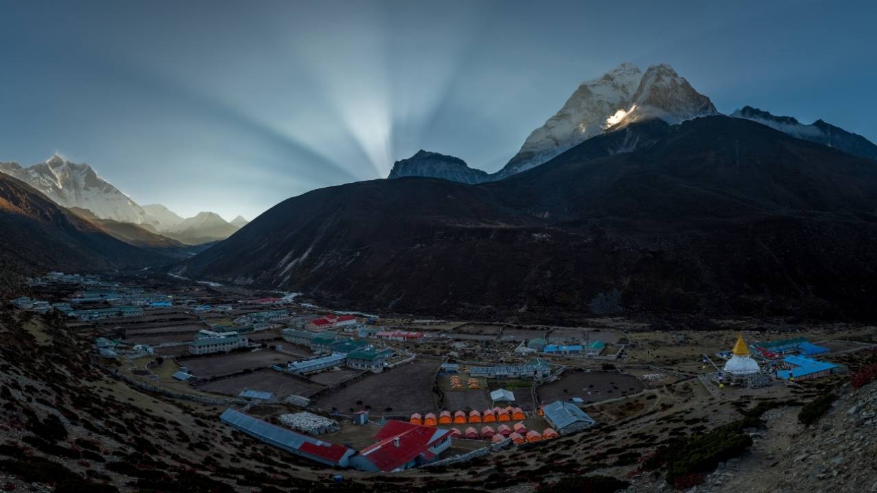
Dingboche is around 4,400 meters. Large stone walls divide the fields around the village, protecting cultivated land and giving the valley its distinctive pattern.
This is another important point in an EBC trek because the altitude is now significant. Most standard itineraries spend an extra night here before moving toward Lobuche.
The acclimatization walk from Dingboche often goes toward Nangkartshang. You climb higher during the day, spend some time there, and return to Dingboche to sleep. I have used this approach many times because it gives trekkers some extra altitude without making the overnight elevation higher.
Dingboche and Life at Higher Elevation
Dingboche is a good place to notice how people make use of limited land. The fields enclosed by stone walls are not large, but they are valuable because there is very little suitable farmland at this elevation.
The village also supports a large number of trekkers, guides, porters, and expedition workers during the main seasons. Food, fuel, gas, building materials, and other supplies have to be transported from lower areas, which makes running a lodge here much more complicated than running one in Kathmandu or the lower Khumbu.
For trekkers, Dingboche is also where I pay closer attention to individual differences. At around 4,400 metres, one person may feel fine while another may need more rest. I would rather slow a group down here than have someone push too hard and develop a serious altitude problem.
Dingboche to Lobuche
After Dingboche, trees become very uncommon. The trail passes through open ground with low vegetation in some areas, while rock and gravel become a larger part of what you walk across.
The route passes toward Dughla and then climbs toward the memorial area above Thukla. The stone memorials remember climbers, guides, and other people who died in the Himalayas.
The climb itself is not especially long, but the altitude makes it harder. You are approaching 4,800 meters, so even a modest uphill section can raise your breathing rate. Walking slowly is normal here.
From the memorials toward Lobuche, the environment becomes increasingly exposed. There is little vegetation to provide shelter from wind, and the trail surface is much rougher than it was around Namche.
Lobuche
Lobuche is one of the final overnight settlements on the standard Everest Base Camp route. At roughly 4,940 metres, there are very few trees and almost no land suitable for normal farming.
The ground around the settlement is mostly rock, gravel, and glacial material. Small plants can survive in protected areas, but they are nothing like the forests around Lukla and Phakding.
The lodges also operate under difficult conditions. Food, fuel, water, and construction materials require transportation from lower elevations, and the village has very little local production to depend on.
For trekkers, the most important change is what your body feels. At nearly 5,000 metres, the amount of oxygen available is much lower than at sea level, so ordinary walking requires more effort.
Lobuche to Gorak Shep
The route from Lobuche to Gorak Shep stays in open high-altitude terrain. The trail crosses rock and glacial deposits, with very little vegetation.
Gorak Shep is about 5,164 meters and is the final settlement used by trekkers before Everest Base Camp. It is normally the base for the Base Camp walk and Kala Patthar hike.
At this elevation, I prefer a slow and steady rhythm. Short steps are usually better than trying to keep the pace you had lower down. There is also no benefit in rushing simply because another trekker is walking faster.
The difference from Lukla is very clear here. There are no forests or cultivated terraces around Gorak Shep. Rock, moraine, ice, and high mountain slopes dominate the area.
Gorak Shep to Everest Base Camp
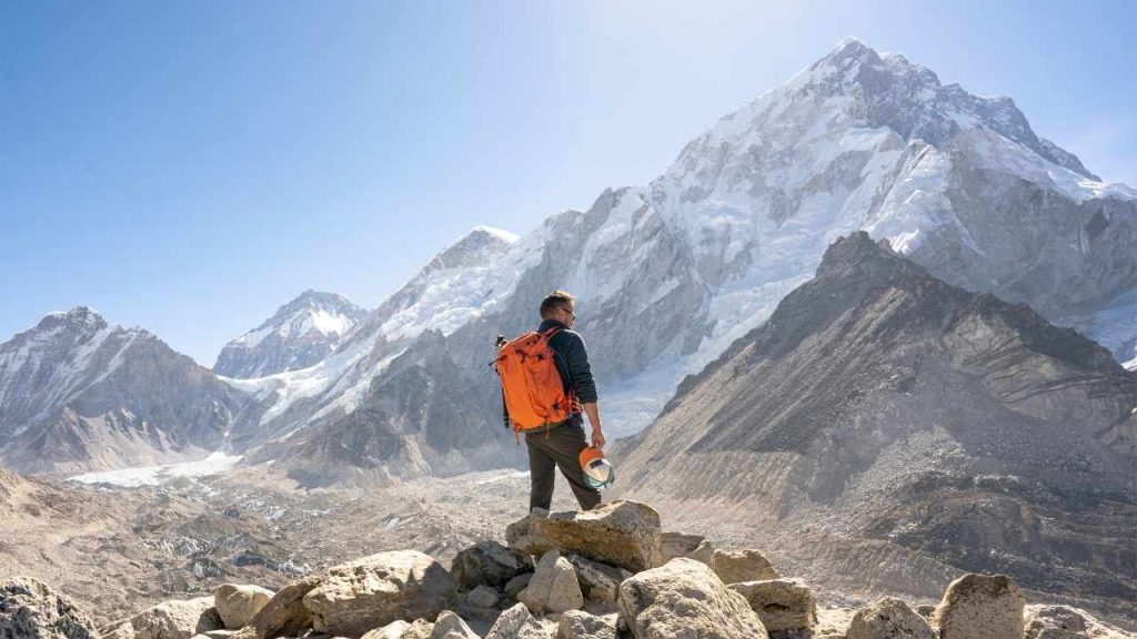
The walk from Gorak Shep to Everest Base Camp follows the area around the Khumbu Glacier. The trail surface is different from the more established paths lower down, with loose rock, gravel, and moraine underfoot.
Everest Base Camp sits at 5,364 meters. During the main climbing seasons, tents, equipment, and expedition infrastructure are set up around the glacier and moraine area.
Base Camp itself is not a permanent village. It is a seasonal expedition site, so its appearance changes depending on the climbing season, weather, and glacier conditions.
Everest is also not necessarily the mountain that looks most prominent from Base Camp. This is one reason Kala Patthar is included in many itineraries. At 5,545 meters, it gives you a different position from which to look across Everest and the surrounding peaks.
How the Vegetation Changes
There is no single point where the vegetation suddenly disappears. The change happens gradually. Around Lukla and Phakding, forests and farmland are common. Around Tengboche and Pangboche, trees remain, but the slopes are more open, while Dingboche has mainly low vegetation and stone-walled fields.
Above Lobuche, plant life becomes limited. Around Gorak Shep and Everest Base Camp, the ground is dominated by rock, moraine, ice and glacier.
| Section |
Approx. elevation |
Main vegetation and terrain |
| Lukla |
2,860 m |
Forest and farmland |
| Phakding |
2,610 m |
Forests, fields, and river valleys |
| Namche |
3,440 m |
Forest and shrubs |
| Tengboche |
3,860 m |
Conifer and rhododendron forest |
| Pangboche |
3,985 m |
Reduced forest and cultivated fields |
| Dingboche |
4,400 m |
Stone-walled fields and low vegetation |
| Lobuche |
4,940 m |
Sparse plants, rock, and gravel |
| Gorak Shep |
5,164 m |
Very sparse vegetation and moraine |
| Everest Base Camp |
5,364 m |
Rock, moraine, ice, and glacier |
The exact appearance changes with the season. Snow can cover areas that are normally open, and spring and autumn can look quite different from winter.
How Khumbu Villages Change with Altitude
The villages become smaller and more dependent on outside supplies as you go higher. Lower settlements have more farmland and trees, while the higher villages have fewer fields and less local production.
Namche has the largest concentration of services on the main route. Pangboche and Dingboche still have a strong connection with farming and local households, while Lobuche depends much more on trekkers and expedition groups.
The buildings also change. Stone becomes more important, fields are enclosed by walls, and homes and lodges have to deal with colder temperatures and a much shorter growing season.
These differences are not simply because of tourism. Altitude, climate, available land, and the length of the farming season all affect how people live here.
The Rivers and Valleys of Khumbu
The Dudh Koshi is the main river feature during the lower part of the EBC route. Between Lukla and Namche, the river stays close to the trail in many places, and trekkers cross it several times on suspension bridges.
After Namche, the route toward Dingboche follows the Imja Khola. Other trekking routes branch into different valleys, including the Gokyo and Chhukung areas.
Higher up, glaciers become a much more important part of the geography. The Khumbu Glacier is particularly important around the final section toward Everest Base Camp.
This river system is one reason the route has so many changes. You begin in a lower river valley, move into side valleys beyond Namche, and eventually reach the glacial terrain of the upper Khumbu.
Weather From Lukla to Everest Base Camp
The weather can be quite different between the lower and upper sections of the route. Lukla and the lower valleys may feel comfortable during the daytime, while Lobuche and Gorak Shep can be cold, especially after the sun goes behind the mountains.
The upper valley also has much less natural shelter. Wind can be noticeable on exposed sections, and temperatures can drop quickly once the sun disappears.
Snow and ice can change the trail conditions as well. I recommend carrying layers that you can put on or remove during the day instead of relying on one very heavy jacket.
Your equipment should also match the season. My Everest Base Camp Trek Packing List explains the clothing and gear I normally recommend for the route.
Walking Pace in the Upper Khumbu
The pace that feels comfortable around Lukla may feel too fast above 4,000 metres. I do not expect trekkers to maintain the same speed every day. As the altitude increases, the body naturally needs more time.
In the upper valley, I prefer short steps and steady breathing. Small rests are useful, but there is no need to stop for long periods if you keep your pace comfortable.
Altitude sickness also needs to be taken seriously. Headache, nausea, dizziness, unusual tiredness, and difficulty sleeping can happen as you gain altitude. If symptoms become worse instead of improving, continuing higher is not the right response.
My Everest Base Camp Trek Altitude Sickness Guide explains the common symptoms, prevention, and what trekkers should do when problems develop.
The Khumbu Beyond Everest Base Camp
Everest Base Camp is only one destination in the Khumbu. Several routes branch away from the main EBC trail and lead into other valleys.
The Gokyo route takes you toward the Gokyo Lakes and Gokyo Ri. The Chhukung Valley leads toward Island Peak and the Imja Valley, while the Everest Three High Passes Trek connects different parts of the region through Kongma La, Cho La, and Renjo La.
I have crossed these passes many times. They are more demanding than the standard EBC route, particularly because of the altitude and changing trail conditions, but they also show parts of the Khumbu that many EBC trekkers do not reach.
So when people talk about the Khumbu, they are talking about much more than the path to Base Camp. Everest Base Camp is one destination within a much larger mountain region.
What I Have Seen Since 1997
When I first came to the Khumbu in 1997, I was a young porter carrying loads for trekkers. I later worked as a porter-guide, completed my guide training, and received my licensed guide certificate in 2002. I founded Mountain World Treks in 2010, but I never stopped walking and guiding in the Khumbu.
There are many more lodges, shops, trekkers, and services now than when I started. Some things have changed considerably, but the basic geography remains. The rivers still follow the valleys, the stone walls still divide the fields around Dingboche, and the upper trail still becomes increasingly rocky as you approach Base Camp.
Walking the same route for many years also teaches you how much the season can change the experience. A section that is dry and easy in one month may have snow or ice at another time. This is one reason I look at the actual conditions before each trek rather than relying only on what happened on a previous trip.
What to Notice While Walking
When you walk from Lukla to Everest Base Camp, look beyond the big mountains. Pay attention to the fields around the villages, the stone walls, the houses, and the amount of vegetation. These details tell you a lot about how altitude affects daily life.
In the lower Khumbu, watch the Dudh Koshi and the suspension bridges. Farther up, the Imja Khola becomes important around Pangboche and Dingboche. Later, the river valleys give way to open ground, moraine, and glacial terrain.
The trail surface is another simple way to notice the change. Around Lukla, you are often walking through forest, and village paths. Around Lobuche and Gorak Shep, loose rock and gravel are under your boots for much of the day.
If you pay attention to these changes, you understand the Khumbu as more than a route to Everest Base Camp. You see how the land, villages, farming, transport, and trekking all fit together.
The Khumbu from Lukla to Everest Base Camp
The Khumbu does not change from one environment to another overnight. The differences build gradually as you walk. Forest and farmland around Lukla give way to Namche, then the forests and monastery around Tengboche, stone-walled fields near Dingboche, and finally the rocky upper valley around Lobuche, Gorak Shep, and Everest Base Camp.
I have walked these trails since 1997, first carrying loads and later guiding trekkers. For me, the Khumbu is not only where Everest stands. It is the villages, rivers, fields, people, and trails between Lukla and the high mountains, and those are the things I want trekkers to notice when they walk this route.
This version is the one I would use for the website. It sounds less mechanically structured while keeping the information organized for readers and search engines.